
Local planning authority
Wyre Forest District Council planning appeals in 2026
No householder or precise planning-condition appeal records are currently linked for 2026. Check the evidence limit below or use any published cross-year issue views.
Your planning decision
Have a refusal decision?
The planned private review will let you bring in the planning authority’s decision notice, identify the disputed points and compare source-located Inspector reasoning from relevant appeals.
Ordering is not open
Evidence to inspect, not a prediction of your outcome.
Appeal research
Compare appeal reasoning by issue
These issue views use Wyre Forest District Council’s published cross-year evidence snapshot. They are not limited to 2026 and do not estimate appeal prospects.
 16 decision familiesArea character and appearanceCompare the development facts, Inspector-stated issue and source-located reasoning in matched local appeal decisions.7 allowed · 9 dismissed · Open evidence
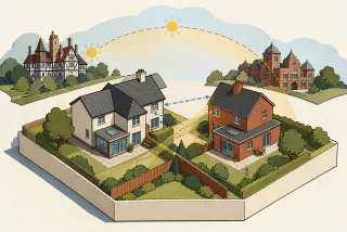 9 decision familiesNeighbour living conditionsCompare the development facts, Inspector-stated issue and source-located reasoning in matched local appeal decisions.5 allowed · 4 dismissed · Open evidence
Planning Inspectorate casework
Householder and condition appeal evidence in 2026
For decisions dated in 2026, this England-only rolling snapshot links 18 selected, decided Planning Inspectorate casework records to Wyre Forest District Council. That is 18 of 124 linked records across the release. The source window represented for 2026 is 1 January 2026 to 30 June 2026; the full release covers 1 July 2021 to 30 June 2026. Of these, 0 unique records appear in the householder or precise planning-condition evidence below.
The linked-casework count is the denominator used below, not a count of planning applications. The source can include specialist casework as well as appeals.
No householder or precise condition appeal records are linked for 2026
18 other linked casework records have a decision date in 2026, but none is recorded as a householder appeal or one of the three planning-condition appeal types shown here. This reflects how the linked casework is classified and the dates covered by the source; it does not mean no relevant appeals occurred.
Authority details
Official identity
- Authority type
- Non-metropolitan district
- Region
- West Midlands
- Official identifier
- E07000239
Planning Data area point: Wyre Forest LPA (52.379587, −2.274642). This is the published representative point for the authority boundary, not a town hall, camera position or appeal site.